|
Interstate 69
final update:
|
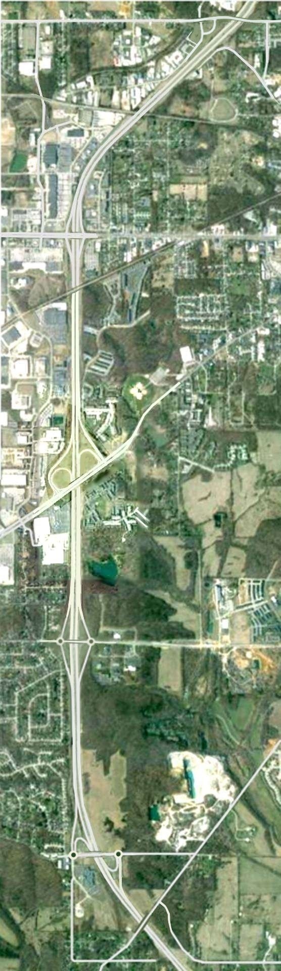
I-69 is open from Evansville to Bloomington.
All new-terrain construction is done.
|
You lost!
Get over it!
|
|
Roads don't cause business failures. High taxes drive firms out of
business.
|
Saving so many miles also saves the gasoline needed to travel those
miles.
|
Every time a car stops, it loses kinetic energy. Eliminating stops saves
energy.
|
|
If they worry about man's welfare, why do they break the law to stop
I-69?
|
|
Many reasons given to stop I-69 are red herrings created by
obstructionists.
|
INTERSTATE 69:
THE DEBATE
|
Roads don't move jobs overseas. Unions price jobs out of the global
market.
|
|
The decision-making period has ended. Now they are waging a fools'
war.
|
Many of the reasons given for not building I-69 are red herrings dug up by opponents, on
the theory that quantity of reasons is more important than quality of reasons.
- Opponents claim improving US-41 will do just as good, but:
- Opponents say too much farmland and wetlands are used up, but:
- A very tiny fraction of available land is used.
- They lamented the 3000 acres to be used to build the highway. Then, a farmer said it
would reduce the utility of his 3500-acre farm. One farm is larger than the total area used
for the highway!
- Farmers can't make money because too much farmland is producing crops.
- All other routes, including US-41, use up more wetland.
- Opponents claim the road will cause more fuel to be used, but:
- The more direct route saves gasoline, compared to current routes.
- People don't drive just to use roads. Trips are made for specific purposes.
- Most trips on the new road would be made anyway, on longer roads using more fuel.
- Traffic lights, stop signs, sharp curves, city driving, and passing slow cars on
two-lane roads waste the most fuel.
- A four-lane divided highway without stop signs and traffic lights will save fuel.
- Opponents say the road will cause too much pollution, but:
- Saving gasoline reduces pollution.
- Most auto pollution happens during idle or acceleration.
- Most auto pollution concentrates at busy signalized intersections.
- Interstate highways don't have intersections or traffic signals.
- They say the Environmental Impact Statement doesn't show the whole impact, but:
- New construction has different impacts than upgrades.
- New construction is not mixed with upgrades. Different forms are used for each.
- Segmented design and environmental impact is normal practice on large projects.
- Conversion to interstate highway design reduces air pollution.
- Opponents say existing roads are adequate, but:
- 20 or 30 mi/hr curves are not "adequate."
- 25 or 30 mi/hr speed limits through towns every few miles are not
"adequate."
- 2-lane undivided roads are not "adequate."
- Crawling behind farm tractors for miles is definitely not "adequate."
- Existing routes are far from direct routes:
- Switz City and Bloomfield are too far west.
- Bedford is too far south.
- The road through Odon zigzags back and forth.
- No diagonal routes in southern Indiana, other than Indiana 67, go from northeast to
southwest.
- Opponents say higher speeds are deadly, but:
- Speed is deadly only on undivided roads, and on roads with bad shoulders.
- A recent study showed that raising the Interstate highway speed limit from 55 to 70
caused no extra casualties.
- Following too close is the most dangerous factor on all highways.
- Speed difference on the same road is more dangerous than high speeds.
- Dividing the highway will prevent deaths.
- Bad drivers have accidents anywhere, but better roads attract them.
- Opponents say the economic benefits do not justify the project, but:
- Personal time saved by shorter trip is not included.
- They don't count removing truck traffic from local roads as a benefit (but they do
count it at meetings about truck routes).
- Fuel savings for trips other than Indianapolis--Evansville were not counted.
- Opponents say foreign trade causes job loss, but:
- They see mainly union labor jobs lost, because the unions make a nationwide stink.
- They don't see jobs gained in new industries foreign trade creates. These appear very
quietly. Nobody complains about new jobs, so they make only the local papers.
- They don't see any gain in the lower prices caused by free trade.
- They don't notice new goods that were not there before.
- Most "lost" jobs aren't lost, they just transplant. If workers move with jobs,
they still have them. Wage rates may be lower elsewhere, but so are tax rates. It's not
the salary's amount, but what it buys that counts.
- If unions and taxes didn't drive them up, wages would be the same everywhere.
- Roads do not cause the loss of jobs. Unions price themselves out of the market when
they lose their monopoly status (which they never should have had).
- Multiple governments tax us out of jobs with a 75 percent total tax rate. And they keep
wanting more.
- Opponents say the limestone industry will be hurt, but:
- There is plenty of time to quarry the stone if they start now.
- Quarry land must be restored by law. It can be done to fit the road at state
expense.
- The construction will require a lot of stone. That's business for the limestone
industry.
- Opponents are against growth, but:
- Growth is necessary to provide jobs for residents already here.
- As the population grows, so must the job base.
- People opposed to growth are also those most likely to have many children.
- Those against growth should stop treating sex as a right, and as a recreational
pursuit.
- Many of the reasons given by opponents are religious in nature.
- Many environmentalist claims are religious, instead of scientific.
- Claims of loss of "spiritual harmony" or of "desecrating the earth"
are from the old earth-worship religions.
- Science has not shown that global warming is caused by man. Global warming has also
been observed on other planets. So reducing carbon dioxide emissions to stop global
warming is a religious belief not supported by science.
- Many of the reasons given by opponents are specious in nature.
- Opponents want the money spent on things that fuel taxes can't ever be spent on.
Examples are schools, sports, and the arts.
- They are still calling for more public hearings on whether to build the project after
the decision to build has been made and the contracts have been let.
- They are still calling for a change in the route of I-69 after a portion of the new
route has been completed and opened to traffic.
- They disrupt meetings with demands that are not germane to the discussions being
held.
- They filed frivolous lawsuits intended to delay the project.
- They keep their political signs up in violation of the election laws.
- Some of them deface or damage property to call attention to their hopeless cause.
- One group falsely purports itself to be a huge multitude against new highways.
- They bring almost all of their members to each public hearing, but represent them as
being residents local to the project.
- They cheat when polling methods are used to determine the percentage of attendees
favoring and opposing the project:
- They stomp their feet in addition to clapping when applause meters are used.
- They raise both hands when a show of hands is asked for.
- They stuff the ballot and comment boxes.
- One time they stole the box of comments left by other people and replaced it
with a box they filled with their comments.
- They also give the "spiritual harmony" and "desecrating the earth"
arguments the earth-worshipers give.
- Their leader "just happened" to have owned property on the planned route
of I-69 southwest of Bloomington.
- Opponents have disrupted meetings and continue to try to stop the project even when
most if it is done.
- They brought up issues that were not germane for the meeting they were at.
- They tried to bring up the no-build option after the decision on what to build was
already made.
- They parked a truck across the entrance to the parking lot where the meeting was
scheduled.
- They pulled the fire alarm to try to end the meeting.
- A protester stole the special cable for the computer-display projector for the
presentations. At a different meeting, they stole the remote control for the school's
ceiling-mounted projector.
- They filed lawsuits to try to stop the project. Often they filed them in courts that
had absolutely no jurisdiction (e.g. county courts) because the judges of those courts
favored their position.
- They got rowdy at a few meetings, and threw chairs at one meeting.
- They filed frivolous lawsuits intended to use up the funding for the project with
legal bills (but the legal costs came from an entirely different state budget).
- Opponents have picketed construction companies and destroyed property to try to stop
the construction.
- They filed frivolous lawsuits against the companies who won the bids. Judges threw
out the lawsuits.
- Opponents blocked the entrances to construction companies so the workers could not
get in to go to work. A few times they dumped garbage or stolen construction signs
in the driveways.
- They drove spikes into trees to be cut down so the lumber could not be sold and
chainsaws would be damaged.
- They damaged construction equipment: One time they filled the cabs of the equipment
with concrete. Another time they hot-wired a bulldozer and smashed it into several other
pieces of equipment. Several times they contaminated the engine oil in the equipment.
- They stole or moved traffic barriers so traffic would drive into the construction
area instead of following the safe routes.
- They spray-painted graffiti on the Statehouse.
- Some of them deface or damage property to call attention to their hopeless cause.
Opponents don't know the whole plan. Here it is:
- The general route:
- Upgrade IN-37 from I-465 to south of Martinsville IN
- Upgrade IN-37 from south of Martinsville IN to Bloomington IN
(under construction).
- New highway from Bloomington IN to Scotland IN (Open)
- New highway from Scotland IN to Elberfeld IN (Open)
- Rename I-164 through Evansville IN (Open)
- New Bridge and interchanges to Henderson KY (5 miles).
- Breathitt Pennyrile Parkway from Henderson KY to Nortonville KY
(Open)
- Ford Western Kentucky Parkway from Nortonville KY to Eddyville KY
(Open)
- Follow I-24 from Eddyville KY to Calvert City KY (Open)
- Carroll Purchase Parkway from Calvert City KY to Fulton KY
(Needs minor changes and two interchange upgrades)
- Upgrade US-51 TN-3 from Fulton KY to Troy TN (under construction)
- I-155 US-51 from Troy TN to Dyersburg TN (Open)
- Upgrade US-51 from Dyersburg TN to I-40 at Memphis TN
- Completed section of I-269 Memphis outer ring from US-51 Millington TN to Collierville TN
(remainder under construction to Nesbit MS)
- Follow I-40 and I-55 through Memphis TN (Open)
- MS-713 from Nesbit MS to Banks MS (Open)
- MS-713 from Banks MS to Robinsonville MS (Open)
- Upgrade US-61 from Robinsonville MS to Clarksdale MS
- US-61 Clarksdale MS bypass (Open)
- Upgrade US-61 and US-278 from Clarksdale MS to Cleveland MS
- New construction from Cleveland MS to Benoit MS
- New Charles W Dean Bridge over the Mississippi River from Benoit MS to McGehee AR
- New construction from McGehee AR to El Dorado AR
- Upgrade US-82 from El-Dorado AR to near Magnolia AR
- New construction from near Magnolia AR to Haughton LA, passing near Haynesville LA and
Shangaloo LA
- New construction from Haughton LA (east of Shreveport LA) to south of Carthage TX
- Upgrade US-59 from south of Carthage TX to Splendora TX
- US-59 from Splendora TX to Rosenberg TX, passing through Houston TX
(Open)
- Upgrade US-59 from Rosenberg TX to Victoria TX
- US-59 through Victoria TX (Open)
- Upgrade US-59 from Victoria TX to George West TX as I-69W
- Upgrade US-59 from George West TX to Laredo TX as I-69W
- Upgrade US-59 through Laredo TX to I-35 as I-69W (under construction)
- US-59 from I-35 to the US border in Laredo TX is I-69W (Open)
- Upgrade US-281 from George West TX to Edinburg TX as I-69C
- US-281 from Edinburg TX to I-2 in Pharr TX is I-69C (Open)
- Upgrade US-77 from Victoria TX to Calallen TX as I-69E
- 10 miles of US-77 from Calallen TX to Robstown TX is I-69E (Open)
- Upgrade US-77 from Robstown TX to Raymondville TX as I-69E
- US-77 & US-83 from Raymondville TX to Brownsville TX is I-69E
(Open)
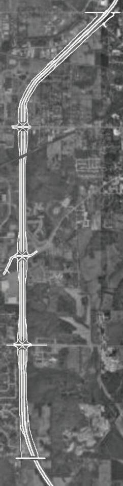
- Specific interchange locations for Indiana:
- I-465 Indianapolis bypass Just west of Harding Street)
- IN-37 Epler Ave & Harding Street, Indianapolis
- Southport Road, Indianapolis
- County Line Road, Indianapolis
- Smith Valley Road, Indianapolis
- IN-144, Waverly
- Henderson Ford Road
- IN-44 and IN-252, Martinsville
- Ohio Street, Martinsville
- IN-39 Martinsville (existing)
- Liberty Church Road & Godsey Road, Morgan County
- Sample Road, Wayport
- Walnut Street Bloomington (existing)
- IN-45 IN-46 Bypass, Bloomington and Ellettsville (existing)
- IN-48 Third Street, Bloomington (existing - slight rebuild)
- IN-45 Second Street, Bloomington (existing)
- Tapp Road, Bloomington
- Fullerton Pike, Bloomington
- IN-37 south, Bloomington (north of Victor Pike)
- IN-45 & IN-445, Cincinnati IN
- IN-45, Owensburg IN
- US-231, Scotland
- IN-58, Elnora
- US-50, Washington (east)
- IN-56 and IN-61 Petersburg
- IN-64, Oakland City
- IN-168, Mackey
- IN-68 and IN-57, Elberfeld
- I-64 and I-164, Elberfeld (existing)
- IN-57, Daylight
- New Harmony Road
- Lynch Road, Evansville
- IN-62 Morgan Avenue, Evansville
- IN-66 Lloyd Expressway, Evansville
- IN-662 Covert Avenue, Evansville
- Green River Road, Evansville
- I-164, US-41, & Kentucky Avenue, Evansville
- I-69 Ohio River Bridge (unknown location)
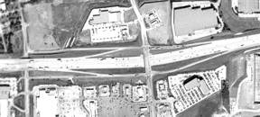
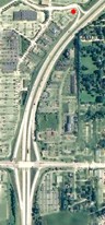
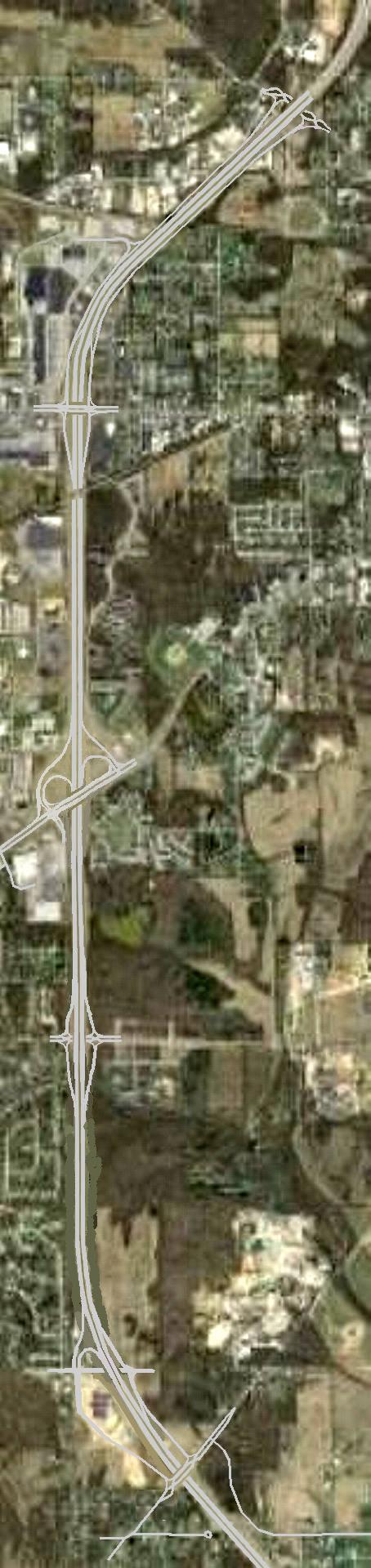
GETTING MORE INTERCHANGE ACCESS POINTS IN BLOOMINGTON INDIANA
The Indiana Department of Transportation (INDOT) says it can't be done. But here is a way
to provide interchange access to all six (or nine) major thorofares that cross Interstate 69.
The thorofares are:
- Walnut Street (north - diamond)
- Indiana 45 and 46 (east bypass -existing 6-ramp parclo)
- Vernal Pike (in the set of 9 - rebound interchange)
- Whitehall Crossing Boulevard (in the set of 9 - rebound interchange)
- Indiana 48 (Third Street - existing diamond modified)
- Indiana 45 (Second Street - existing parclo modified)
- Tapp Road (diamond)
- Fullerton Pike (2 quadrant parclo)
- Rockport Road (in the set of 9 - rebound interchange)
The Walnut Street, the Indiana 45/46, the Indiana 48, and the Indiana 45 interchanges
already exist. But the last two might be modified. That leaves four (or seven) access
points that can be modified:
- Vernal Pike (set of 9 - rebound interchange)
- Whitehall Crossing Boulevard (set of 9 - rebound interchange)
- Indiana 48 (Third Street)
- Indiana 45 (Second Street)
- Tapp Road
- Fullerton Pike
- Rockport Road (set of 9 - rebound interchange)
INDOT says that Vernal Pike can't have any interchange because it is too close to the
Indiana 46 interchange. But INDOT will provide a method using extra lanes for having
interchanges at both Second Street and Tapp Road. Rebound interchanges allow full access
to all of these roads.
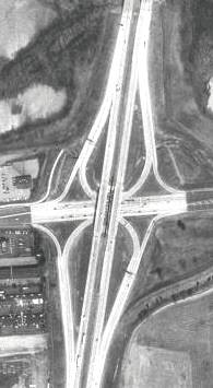
What is a Rebound Interchange?
 Here is an example of a rebound interchange near Dallas TX. In this photo
(upper right), the eastern (right) crossroad has a full diamond interchange. The western
(left) crossroad is connected by the rebound interchange ramps to the ramps of the
diamond interchange, as shown. The crossroad on the west actually has full access to the
freeway:
Here is an example of a rebound interchange near Dallas TX. In this photo
(upper right), the eastern (right) crossroad has a full diamond interchange. The western
(left) crossroad is connected by the rebound interchange ramps to the ramps of the
diamond interchange, as shown. The crossroad on the west actually has full access to the
freeway:
- The west crossroad accesses the freeway to and from the east directly, by using the
ramps that cross the eastern crossroad.
- Entrance to the freeway westbound from the west crossroad is accomplished by using
the eastbound rebound ramp to get to the eastern crossroad. The traffic then crosses the
eastern crossroad's bridge, and enters the freeway using the westbound ramp.
- Exit from the eastbound freeway to the west crossroad is accomplished by using the
eastbound exit ramp to get to the eastern crossroad. The traffic then crosses the eastern
crossroad's bridge, and uses the westbound rebound ramp to get to the west crossroad.
So the western crossroad actually has full access to the eastern crossroad
and to the freeway, not just the half access that it appears to the eye to have.
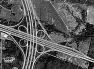
 A half-rebound interchange existed at Whitehall Crossing Boulevard (lower right) before
I-69 construction began. The rebound ramps are next to the red dot.
A half-rebound interchange existed at Whitehall Crossing Boulevard (lower right) before
I-69 construction began. The rebound ramps are next to the red dot.
- Southbound traffic could exit to Whitehall Crossing.
- Northbound traffic could not exit directly to Whitehall Crossing. Drivers wanting to go
there had to take the Third Street exit, turn left, and then turn onto Gates Drive.
- Entering traffic from Whitehall Crossing could go directly southbound.
- Entering traffic from Whitehall Crossing can use the rebound connection to go northbound
by taking the exit to Third Street, crossing the bridge, and taking the northbound entrance
ramp.
This was removed as part of the I-69 construction. The rebound ramps were too
close to the Third Street ramps to meet Interstate highway standards. Also, the curves on
the ramps were too tight to meet the standards. All access is now through Gates Drive.
In the diagrams below, north is at the top. Each road has a caption next to it.
The left diagram was the original SPUI proposal, the middle diagram is a DDI proposal, and
the right diagram is the actual plan.
In the left diagram, Vernal Pike is connected to 17th street on the east end, to allow
placement of the overpass. This INDOT proposal conflicts with the traffic calming Bloomington
put on 17th Street.
In the left diagram, the CD roads exit and enter I-69 just south of Vernal Pike, and just
north of Fullerton Pike. I-69 has one exit ramp and one entrance ramp in each direction to
handle all traffic to and from all five roads. In addition, the CD roads can also transfer
traffic between the crossroads.
In the left diagram, the interchanges at Indiana 48, Indiana 45, and Tapp Road are all of
the Single Point Urban Interchange (SPUI) type. This kind of interchange has one signalized
intersection in the middle of the bridge that handles all left turns. The SPUI is more
efficient than any of the interchanges now used in that area. An example of a SPUI can be
found at Indiana 46 and Interstate 65 in Columbus Indiana.
In the middle and right diagrams, the interchanges at Indiana 48 and Indiana 45 are the
existing interchanges, slightly modified.
In the left diagram, the interchanges at Vernal Pike and at Fullerton Pike are rebound
interchanges. They provide full access to these cross streets through ramps away from the
cross streets.
- For the Vernal Pike interchange in the left diagram, the CD roads provide access to and
from the south directly. An extra rebound turnback (U-turn) ramp on the Indiana 48 SPUI
provides access for Vernal Pike to and from the north, by allowing traffic to move from the
southbound CD road to the northbound one.
- The arrangement for Fullerton Pike (left diagram) is exactly the same, except that
direct access through the CD roads is to and from the north. The turnback ramp at the Tapp
Road interchange provides access for Fullerton to and from the south.
In the middle diagram, the interchange at Vernal Pike is a rebound interchange DDI. It
provides full access through ramps away from Vernal, and also provides access for Whitehall
Crossing Boulevard. The interchange at Tapp Road is a DDI, and the interchange at Rockport
Road is a rebound DDI. And the interchange at Fullerton Pike is a 3-quadrant parclo.
- For the Vernal Pike interchange and Rockport Road interchange, the rebound ramps provide
access in all directions through the adjacent interchanges.
- The half rebound interchange at Whitehall Crossing has full access through Vernal Pike
and Whitehall Pike (IN-48).
| The Indiana 46 and Indiana 45 interchange is just out of sight above the
top edge of the picture. It is too close for any connections at Vernal Pike that handle
traffic to and from the north |
The Original SPUI Plan
|
The DDI Plan
|
The Actual Plan
|
| Vernal Pike has a rebound interchange with full access in the left two photos.
On the right, access is via a possibly extended Gates Drive. |
Uses expensive single point urban interchanges
|
Uses cheaper diverging diamond interchanges
|
What INDOT is building (with additions)
|
| Whitehall Crossing Blvd (middle) had an existing half rebound interchange with 3/4
access. Note collector-distributor (CD) roads in first two photos. In the actual plan,
this is closed. |
| The left Indiana 48 interchange is a SPUI with U-turn. The other two use the existing
diamond. |
| Note the railroad overpass south of IN-48. The left photo has CD roads here and needs a
new bridge. The other two add extra lanes between ramps. |
| Indiana 45 has a SPUI on the left. The middle and right plans use the current
interchange. A split diamond was originally planned for Indiana 45 and Tapp Road. |
| The left photo shows CD roads, and the middle and right have extra lanes. |
| The left Tapp Road interchange is a SPUI, the middle one is a DDI, and the right one
is a roundabout diamond (originally a split diamond). |
| Note the CD roads in the left photo. The middle and right photos might have extra
lanes between the ramps. |
| The left Fullerton Pike interchange is a rebound interchange. The middle has a
3-quadrant parclo, and the right has a roundabout 2-quadrant parclo. |
| There is no Rockport Road interchange in the left or right photos. An overpass exists
in each case. The middle Rockport Road interchange is a rebound DDI. But Rockport is close
enough to Fullerton. |
| Right click on any picture and choose View Image to see it full size. |
The I-69 and Indiana 37 interchange will be built just out of sight below
the bottom edge of the picture. It will be too close for any direct connections at Rockport
Road or That Road that handle traffic to and from the south. |
|
Thus, all of these streets have full access to I-69.
Note that the connection to the east end of Vernal Pike in the left diagram can be two-way
from Vernal Pike to 17th Street. This allows traffic to flow on Vernal Pike as it does now.
And if it becomes an issue, the connection to 17th street is not necessary, even though the
bridge is placed there.
The last interchange on the south can be either Rockport Road or Fullerton Pike. Both
designs will work either way.
|
What's a SPUI
|
What's a CD Road?
|
What's a DDI
|
What's a Split Diamond
|
|
A Single Point Urban Interchange (SPUI) has the basic function of the diamond
interchange, but all of the left turns come together at a special intersection, usually
under the bridge or on it. Left turns from opposite directions move simultaneously without
crossing paths. The traffic signal cycle for the SPUI is simpler and more efficient than
one for a diamond.
A rebound compatible SPUI has turnbacks for rebound interchanges and CD roads.
|
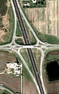
Collector-Distributor (CD) roads are one-way roads paralleling the freeway. As seen in
this photo, the ramps of a full cloverleaf can be connected to them, with less weaving
trouble with close exits and entrances.
CD roads are connected to the freeway away from the interchange, protecting high-speed
lanes from the weaving maneuvers of entering and exiting traffic. This allows more access
points to be provided in a given area.
|
A Diverging Diamond Interchange (DDI) has the main roadways of the cross street braided.
They cross each other at the two signalized intersections. Traffic on the cross-street
bridge drives to the left of the center divider. The bridge is smaller and much cheaper
than the one on the SPUI. All signals are two-phase.
A rebound DDI is a half DDI functioning as a rebound interchange. A rebound compatible
DDI has CD roads.
|
A Split Diamond Interchange is built when two cross streets need access to the
freeway, but they are too close together to have their own interchanges, even with CD
roads.
The split diamond ramps service both streets. A driver using a split diamond ramp may
have to pass through an intersection on one cross street to go to or from the other cross
street.
A split diamond is fully rebound compatible.
|
CONNECTING ROUTES
between local Bloomington Indiana roads formerly
connected to Indiana 37 and the new Interstate 69
HOME PAGE

This page is written as Valid XHTML 1.0 Strict.
It validates at W3C Validator when isolated.